In our project, landscape and building play equal parts, as they do in this "new” Geneva.
We have interpreted the "figure” of the terrain as a mathematical graph: a paraboloid described by two axes. Rue de la Paix is the paraboloid, Route de Ferney/Avenue de France, the X-axis, the Palais des Nations, the Y.
The critical area of the competition is the Place des Nations, where X, Y and the paraboloid come together, and where the architecture will reach critical mass.
The graph divides the area in distinct fields, each with their own urbanistic character and potential.
The area "inside” the paraboloid is interpreted as a picturesque park, which accommodates the implantation of a number of UN buildings, international organizations, like the WTO and other future UN buildings.
Between paraboloid and X-axis, the park is contained by a denser zone of buildings and vegetation; it becomes fully urban only at the point where it intersects the Place des Nations which is flanked by the Universal House and an educational cluster formed by the AIHIS library sandwiched between SMART and the Academic Institute for Political Science.
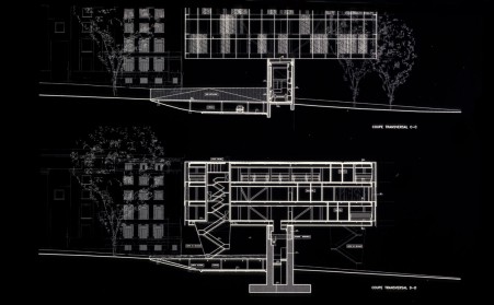
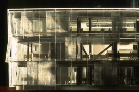
The Maison Universelle is a horizontal plate of individual missions suspended over a public portico. The library is interpreted as a mixing chamber that feeds knowledge to both adjoining institutions, and cements vertical elements into a larger whole.
The Place des Nations is not just a place, but a linear condition that mediates between the UN and the City - a continuous granite surface that follows the natural contours of the terrain.


 cityup.org 传真电话:010-88585380


